Maya’s travels of the Dempster Highway
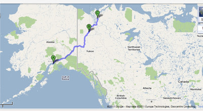
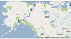
The Dempster Highway is also known as Yukon Highway 5 or Northwest Territories Highway 8. This Canadian highway originates about 25 miles east of Dawson City, Yukon on the Klondike Highway and spans about 457 miles to Inuvik, Northwest Territories. The road was originally known as Highway 11 and was actually an old dog sled trail. After 1978, it was renamed the Dempster Highway after William John Duncan Dempster, an officer of the Royal Canadian Mounted Police. Dempster was sent out to rescue another missing officer; however, he and his team of three men never made it to Dawson City. It was later discovered that they got lost on the trail and died from exposure and starvation. موقع بيت 365 لكرة القدم
The creation of the Dempster highway stemmed from the discovery of oil which motivated the Canadian government to build a road across the Arctic Circle to transport equipment. However, the unexpected high cost of the project as well as disagreements between the federal and Yukon governments hindered its progress. The project was eventually abandoned in 1959 after 71 miles of road was built. موقع بوكر In 1968, large reserves of oil were discovered in Prudhoe Bay, Alaska which renewed the Canadian government’s interest of the project for fear that the United States would develop the area first. تنزيل لعبة روليت Subsequently, the Dempster Highway (Canada’s only all-weather road across the Arctic Circle) was officially opened on August 18, 1979.
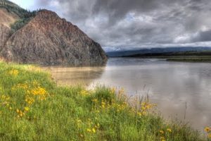
Maya’s adventures on this gravel-surfaced, all-weather highway include ferry crossings, washouts, excessive mud, and stepping outside of her comfort zone.
Maya has traveled the Dempster to Inuvik twice, once in 2011 and once in 2013.
Read about 2011
Read about 2013